What is crawling on my tyre?
Isn't it remarkable how some of the smallest things in life can restore a sense of perspective to a temporarily irrational mind? For some reason I took yesterday badly (as evidenced by the post below). I really don't know why I took it so badly -- often I've consoled friends who have failed exams by pointing out that one exam is not going to ruin a life. However, I wasn't thinking that way yesterday -- nor early this morning it seemed.
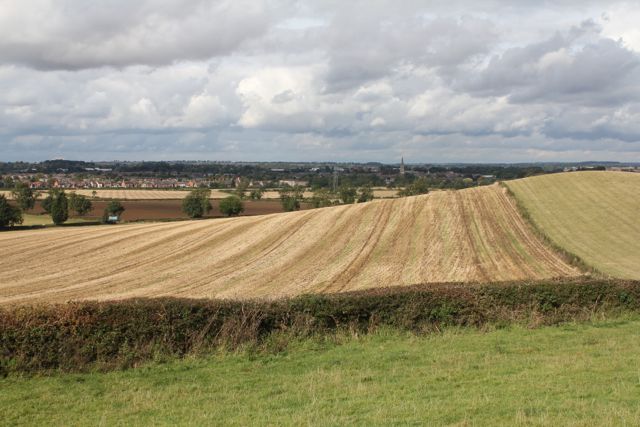
I knew I needed to get on the bike in order to get over this, but this morning I woke up feeling lethargic. It was almost like I didn't care. Eventually I forced myself to get out there, heading for Tallebudgera Valley. As usual, it was a beautiful ride once I got away from the urban sprawl of the coast.
It was only after getting back to one of my special places by the banks of the creek well away from civilisation that I started to restore some perspective to my mind.
Yet it was only when I walked back to my bike for the ride home that I noticed that little green fly sitting on my wheel. Strangely, I've never noticed this creature before. As far as I was aware, flies only came in one colour -- black (apart from the glow worms at Austinville of course). It was at that moment that I realised that this indeed wasn't the end of the world by a long shot. Heck, my problems are minute compared to what some others are suffering at the moment. I have been reminded once again that in pursuit of our goals and ambitions, we shouldn't lose sight of the little things that make the world such a special place.
As far as the journey goes, I will get there eventually. In this case, it might just take a little longer than I had anticipated. So who would have expected such insights to come from a fly?
Tuesday, November 27, 2012
The fly


Thursday, November 22, 2012
300k -- finally!
I have waited a long, long time for this one. Up until the weekend, I had never ridden 300km in a day -- despite having gone beyond 280km on no fewer than five occasions. Technically I probably still haven't -- given that this ride started in the afternoon and continued through the night. On the other hand, there were 310km covered between arrival in Caboolture and the return there for the train home (plus another 14km on the 'Coast getting to and from the train), so I'm claiming it.
This ride arose from a desire to participate in the Audax 200km night ride starting and finishing in the town of Kilcoy, north-west of Brisbane. It was getting to and from the ride that would present the extra kilometres I was seeking, as it is 50km from the nearest train station in Caboolture (actually, by the route I took it was a little further, but who's counting?).
The ride from Caboolture to Kilcoy is quite a pleasant one. There are early views of the Glasshouse mountains in the distance, and some very pretty bushland to pass through, particularly on the Neurum road detour. Arrival in Kilcoy presented a bigger turnout than expected, until I realised there was a 50km ride being run at the same time as my 200k. The early part was on a familiar route, passing Mt Kilcoy, one particularly nasty wooden bridge where I had a very nervous moment, and returning to Kilcoy on the Jimna Road I used en route to Mt Buggary last September.
It was after leaving Kilcoy (again) and heading for Esk that the drama really started. First of all, my chain was making some noises it shouldn't have been. I'd had a rear derailleur repaired in Hobart a few weeks ago, and they had told me they'd needed to take the chain apart to do it. I began to wonder if that was the problem. Then I discovered a slow leaking flat on the rear tyre -- not a problem as I had a spare tube, right?
Wrong. The MTB tube was still in the saddlebag, and wasn't going to be much use to me out here. Oh well, it was only a slow leak, if I pump it up enough I might make it to Esk. For some reason I also started thinking of last week's knee problems -- although they gave me no problems at all tonight.
All of these concerns somehow cancelled each other out, and I was able to relax and really enjoy the night. The temperature was glorious, as were the twilight views of Lake Somerset (which I'd see again later). Someone in a passing car even shouted encouragement (normally they shout abuse on the Gold Coast). I did have to re-pump the rear tyre before Esk, but even that didn't bother me.
Shortly after leaving Esk it dawned on me that I had no idea at all what the time was. I had assumed it was getting late, but somehow I was so lost in this ride that keeping track of that simply didn't occur to me. I was more concerned with the moon sailing through the sky and lighting up Lake Wivenhoe in such a way that can be viewed for hours, but never photographed.
A little later just after the climb at Wivenhoe power station I renewed acquaintances with Lisa from Inverell who I'd ridden with for 170-odd km on an ill-fated 600k attempt last year. We had something to talk about as about 35 cars suddenly went past at high speed. If 35 cars suddenly pass at high speed at 1.00 am it usually means one thing. Our suspicions were confirmed at the next intersection -- there were about 50 hoons out for some drag racing.
Fortunately, the road ahead had more corners than the road behind, meaning they weren't going our way. Even more fortunately, they were surprisingly polite when we passed them. At least it gave us something to talk about. At the next checkpoint it was clear that my rear tyre was now going to need to be patched. This was the first time I've done this in the dark, and it took a little longer than usual.
The tube patched and the offending piece of glass removed, I set off again, and discovered my front tyre now had a similar problem. I just pumped it and figured I'd deal with it later (i.e. preferably when it was daylight again). The remaining ride to Kilcoy to "officially" finish was up and down, with one almighty climb before rejoining Lake Somerset. I negotiated these and watched the light starting in the eastern sky. Daylight comes about 4-4.30 am in these parts, which was about the time I made it back into Kilcoy.
I was offered a ride home and declined -- I wanted to finish off this 300 properly. I started feeling a little tired on the Neurum road (for the second time in 24 hours). I fixed the front tyre properly to keep myself awake, and pressed on. One again the scenery on this road provided the inspiration, as did the prospect of making it to Woodford and a bakery for some breakfast.
The final stretch back to Caboolture was almost surreal. My legs were just about shot, but continued to find enough for the rolling hills as they came along. I was counting off each of the "failed attempts" in the 280's and 290's. I did raise a fist when the 300 came up, however, the end of the ride was something of an anti-climax. As I rode into Caboolture, I couldn't help thinking what an unremarkable dump that place is. I'm sure it has some redeeming qualities for someone, but it's just not for me.
As to where I go next, well, there is a 300km ride starting from Esk early next month. It's another all-nighter, but after this experience, I think I'll give it a go. Transport to and from Esk shouldn't be as difficult as there is apparently a bus service there from Ipswich (to where I could catch a train). On the other hand, it's only 67km from Esk to Ipswich, maybe I could just ride it.


Monday, November 19, 2012
The Drive That Wasn’t Meant to Be
We went to bed last night to a downpour. We woke up to a downpour. And did it ever pour! It was the kind of rain that overpowered the sound of Little River rushing over rocks and boulders. It rained, and it rained, and it rained. Finally, around 1:00p, it started to let up a bit. So, we considered our options. We could go to the Heritage Center; but the ongoing drizzle and possibly soggy ground was a deterrent. We could stay at home; but we wanted to get out for some fresh air and a change of scenery. We could go for a drive. Perfect, see some sights in the park and stay dry in the process.
At the Cades Cove/Gatlinburg split a short distance inside the Townsend entrance to the park, we turned left to head towards Gatlinburg. We didn’t know if we’d make it all the way there, but we wanted to see what we could uncover on Scenic Highway 73, which runs alongside Little River. Of course, I couldn’t resist a couple of river shots.

After all that rain, there’s no lack of water flowing downriver.

As beautiful as the flow of the water is, it is endangering the trees along the riverbed by exposing their roots and eroding the soil that is supporting them.
Our next stop was at The Sinks, which is better described as a big cascade rather than a waterfall. Regardless of what you call them, the turbulent waters rushing down into the gorge are very dangerous. The currents are strong enough to trap victims underwater and keep them there. I saw some photos of kayakers running the chute; all I can say is that they must be nuts to attempt something so obviously risky. We didn’t see anyone jumping into the water from the nearby cliffs, nor was anyone wading, but it’s apparently not unknown for people to do both despite the warning sign posted in the parking lot. People have drowned here; most recently a 17-year old girl last summer. She was wading when she slipped and fell into the water. Other visitors tried to save her by forming a human chain, but their efforts were to no avail.

A path hidden by the trees rewards us with this view.

Despite the ongoing drizzle, we find a dry spot for a photo op.
Mui has a request for proposals (RFP) out for events he’s organizing in May. When we returned to the car, he had a message on his Blackberry that there were 43 questions from vendors interested in bidding for the job waiting to be answered. We could have continued with our plans for the afternoon and he could have done his work the next morning, but it seemed like a better plan for him to get the job out of the way on a drizzly afternoon.
Thus we set off back to the campground, almost missing a great photo op along the way. Mui’s eagle eye, however, caught a tiny glimpse of a treasure hidden by heavy brush on the far side of the river. When I questioned why he had pulled off the road, all he would tell me was to take my big lens and the tripod, and walk back a few feet. The big lens immediately made me think that he’d seen some wildlife, but it turns out that he’d seen a waterfall. Yes, more flowing water pictures follow :-)
 |  |
The picture on the left shows what caught Mui’s eye as we whizzed by at 30 mph.
 |  |
At full zoom I can get only two of the cascades that make up Meigs Falls.
visitors can hike to many of the falls in the gsmnp; this one can only be seen from the road.
[though I’m partial to the B&W treatment, I couldn’t decide between the two photos,
so you get to see both.]
After this last stop, we drove back to the campground without dallying further. Despite the light rain, we settled ourselves at the picnic table on the covered deck with cups of hot chocolate and our laptops. While Mui did his work, I processed photos and tried to catch up on my reading — a lost cause, I’m afraid.
All in all, cutting our outing short was the right decision. If the local forecast is to be believed, we have a really great day ahead of us to finish exploring the heritage sites on the Cades Cove Loop.
(By the way, for those interested, gas for the toad in Townsend today was $3.69/gallon.)
Flat tires: The ultimate cycling buzz kill

No matter what kind of bike you have, if you ride enough miles, you're going to encounter a flat tire at some point.
There's never really a convenient time for it, and unless you do the majority of your biking within two blocks of your house or a bike shop, it's not going to happen at a convenient location either.
Anybody who's kept up with my blog knows that I've encountered my fair share of flats on a bike. Three during a trip to Blue Earth, a flat at the the turnaround point of a 20-mile ride (long run home), and a valve breaking in the middle of Minneapolis.
Some people might wonder why I ride so much if I encounter so many flats, and the answer simple: I'm not afraid to deal with them. It's a pain in the rear to change a flat -- especially if you've got some place to be at a certain time -- but to avoid riding because of it is idiot's logic. By that reasoning, you shouldn't drive your car either because you might have to fix a flat.
I bring this up because I encountered my first flat of on my way to the mall yesterday (more specifically Barnes & Noble). It occurred on Adams Street about a block shy of the BioLife Plasma Center, which meant I was about half a mile from the mall.
Taken at face value, this doesn't seem like a bad place to encounter a flat, what with Scheel's being in the mall and all. But being the prepared cyclist that I am, I happened to have a patch kit and air pump with me and decided to fix the flat right there and then. After a few tire lever struggles, a lot of grease and a little swearing, my bike was right for riding again.
This worked out fine for getting to mall. I locked my bike up, read for a couple hours at Barnes & Noble, and the tire was still inflated when I left the mall.
But on the way home, guess what happened? Another flat.
This time, while removing the tube, I determined that there was a small hole in the tire itself (for terminology's sake, the tube is the inner part of the tire with air in it, and the tire is the outer shell). Even if I had replaced the tube, the tire likely would've gone flat again shortly, as a hole in the outer shell makes the tube more susceptible to rocks,glass and whatever else is on the road.
Luckily, the flat occurred about five blocks from my apartment. So the walk home was relatively short. However, in order to get my bike in working condition again, I was going to have to (gasp!) drive to a bike shop to get a new tire.
Since I'm currently trying to run/bike more miles than I drive in my car for a month (blog entry here plus you can view my monthly totals on the right-hand side of the blog), I'm obviously reluctant to use my car unless it's absolutely necessary. But I really didn't have much of a choice, unless I wanted to walk it the 4+ miles to Scheel's (the only bike shop in town that's open on Sundays).
Had I not been so adamant about fixing the initial flat myself, I could've walked over the Scheel's while at the mall, gotten my bike fixed and saved the car trip -- a trip I had to make a hours later anyway.
Oh well, I guess hindsight's 20/20.
As a reference point, here is a pretty decent YouTube video on how to change a flat tire on a bike.
Wednesday, November 14, 2012
One Simply Cannot Get the Staff
 |
| Do not entrust the making of tea to servants |
Blend your teas thoroughly well and keep in a closed tin in a dry place.
Do not entrust the making of this (or any other tea) to servants. The scalding of the teapot and making of tea with freshly boiling water are essential: and this is what servants usually ignore.
Water that has been boiling some time will not "draw" tea properly: much less so, water that "has boiled" which is too frequently made use of by servants.

Hints on Food Storage:
It is essential that all store-provisions should be kept covered otherwise they accumulate dust and germs, and become unfit for use, even though they may appear so.
This is a fact which no servant can get into her head, and which requires constant attention.
Monday, November 12, 2012
In the Spotlight: Before the Coasties ...
21 April

Located in Rodanthe, just over 
As it turns out, the weather held off, except for a light drizzle. By timing our visits to the buildings carefully, we managed to scamper from one to the other without getting wet.
We were greeted warmly by the docents at the front desk of the station-turned-museum. When Mui showed them his USAF ID, they generously gave us the group rate of $5/person ($1/person discount). The program of the day is included in the admission price, but since they are conducted during the summer months, we made do with a video documenting the history of Chicamacomico and then moved on to a self-guided tour.
 | illustration of the chicamacomico historic site and museum grounds(A) 1874 Station(B) Wreck Pole(C) 1892 Cook House(D) 1907 Midgett House(E) 1911 Cook House(F) 1911 Station(G) Stable(H) Tractor Shed(I) Small Boathouse[scanned from the museum brochure] |
The US Life-Saving Service (USLSS) was founded in 1871 and was managed by the US Treasury Department. Local men were hired and trained for one primary task: to rescue those in peril from the sea. Their mission is underscored by the surfman’s motto as stated by a station keeper:
The book says ya gotta go out; it don’t say nothin’ ‘bout coming back!
In 1915, the USLSS merged with the US Revenue Cutter Service to form today's US Coast Guard.

Historic photographs from around the museum.
Left (top to bottom):the breeches buoy was used as late as | right (top to Bottom):the surfboat landing with shipwreck survivors; note the cork life jackets worn by the men.Cape Hatteras was dangerous for sailing ships, yet ships sailed near to get around the cape and to use the lighthouse as a landmark for the quickest route north or south. |
Built in 1874, Chicamacomico was the first USLSS station in North Carolina. It remained in service until it was decommissioned in 1954. The name comes from the Algonquian family of languages and means, quite appropriately, “land of disappearing sands.” (Best pronunciation guide I can find … Chic-a-ma-COM-i-co.)

The Chicamacomico Life-Saving Station Historic Site and Museum as seen from the beach.
Left to Right: The 1911 Station; the 1874 Station; the 1892 Cook House and water tank;
the 1907 Midgett House.
[taken the next morning; hence the clear, blue sky.]
We started our tour in the 1911 Station, which replaced the smaller 1874 station. The building, which contains the majority of the exhibits, is still on its original foundation. Although the station was designed for no more than 10 men, over 40 were stationed here during WWII. Having been inside, cramped would be an understatement in describing the conditions at that time.

The 1911 Station with the Cook House to the right. the bell is not original to the site;
it was removed and brought here from the Chesapeake Bay.
Before moving on from this building, we climbed the ship’s ladder from the second floor up to the tower. A second story was added inside the tower to ensure that both the Atlantic Ocean and Pamlico Sound could be monitored. A surfman was on watch 24/7, rotating in 4-hour shifts. Nothing but binoculars, a chart book, and a podium-type desk was allowed in the tower. In other words, nothing to distract the men from charting the safe passage of vessels traveling up and down the coast, and remaining alert to ships that might be in distress.
 |  |
The steep ladder leads into the tower from which we can see the 1874 Station,
the 1892 Cook House, and beach homes overlooking the Atlantic Ocean.
Our second stop was at the 1907 Midgett House, which was brought to the site in 2005. It was originally owned by the brother of Keeper John Allen Midgett Jr., one of several keepers that shared the surname.
Furnished with items appropriate to the period, the 1907 Midgett House is intended to
interpret daily life on Hatteras Island in the early 1900s.

A peek into life in the early 1900s.
Next we walked through the 1874 Station, which was converted to a boathouse in 1919. The building has been moved five times; its original location is now under water. Inside we found some fascinating rescue equipment, as well as Surfboat No. 1046, which was used in 1918 to rescue 42 people from the Mirlo, a British tanker that was torpedoed off shore. (Rescue account here.)

The Gothic style 1874 Station and the wreck pole in the distance.

On the side facing the Atlantic Ocean, the 1874 station looks more like a boathouse.
In the open doorway, you can see a glimpse of Surfboat No. 1406. Immediately to the
right is the 1892 cook house and water tank, and next to that is the 1907 Midgett house.

Left: Life Cars were used to rescue people from a wreck.
Right (Bottom): surfboat No. 1406 was used to rescue survivors from the mirlo.
(For those interested in how the life car worked [from signage at the museum]: it was hung unto the hawser [thick, heavy line] and sent to the wrecked ship. Crew and passengers would climb into the hold, seal the hatch, and be hauled to shore by the surfmen. Even after the breeches buoy was adopted, stations retained their life cars in the event a ship had an injured crewman or small children aboard. Up to seven adults could fit into the life car.)
Have you heard of the breeches buoy rescue? We had not until we visited Chicamacomico. We were fascinated by what was described in the signage as a British-style rescue method. The way I understand it, a Lyle gun was used to send a hawser from the shore to the wreck. A wreck victim would then jump into the ‘breeches’, and suspended in the air, he would be pulled ashore by a pulley-block system. Once ashore, the victim would ‘jump out of his breeches’, and the buoy would be sent back out to the ship to rescue another person.

Breeches Buoy Rescue Equipment with a photo of a mock-up showing how the rescue worked.
From the 1874 station we strolled over to the wreck pole at the far edge of the property. The pole, which simulates the mast of a ship, was used by the station crew to hone their breeches buoy rescue skills. They were allotted five minutes to have all their equipment in place and “rescue” a practice victim, usually a fellow surfman. Sure, the beach cart was on wheels, but can you imagine how difficult it must have been to roll it through the sand to get it positioned before they could shoot the gun?

Collage of images showing the wreck pole and illustrations of how the breeches buoy
setup was used in shipwreck rescues. During the summer months, the US Coast Guard conducts
breeches buoy rescue drills at the station. The photo in the bottom right
shows the drill team from Oregon Inlet.

It was due to the intense training the surfmen did at poles like this one that the USLSS
was able to come to the aid of 177,286 of 178,741 endangered souls.
We stand in awe of the men (and women) who put their lives at risk to save others from the perils of the sea — then and now.
If you’d like to see the full-size versions of the photos used in the collages, visit our online gallery.
Echo Company Reunion - Day 1

Relative slow day at the reunion. Folks are still getting into Las Vegas. Had breakfast breakfast at the hotel buffet. Nothing much to write about = normal fare, food not very hot.
Spent some time at the hospitality room visiting. Late morning headed out to find a local bike shop, preferably a Trek dealer. Headed out to the West side to Mc Ghie Ski Bike And Board. Friendly staff. Picked up a city bicycle map (actually "Southern Nevada Bike Map") and an adventure guide. The adventure guide maps hiking trail, mountain bike trails, and rock climbing areas West of town - the Red Rock Canyon area. Guide published by Franco Maps. (See photo taken at Red Rock Canyon.)
The suggestion for dirt trails was riding in the Cottonwood Valley area. I was thinking of riding the road bike from the hotel. I was told "To NOT ride in the hotel/strip area". Suggested to go out to Henderson to ride on the 34 miles bike path loop.
Too windy to head out ride today (though saw quite a few cyclist out today). While on the West side of town, headed over to Red Rock Canyon National Conservation Area. Drove the scenic Byway and stopped for some photos.
Back to the hospitality room and more visiting. Took a break up in the room and process photos. Spent the evening back in the hospitality room.
ML8 ML8

Can you guess what kind of car I was once tempted to buy, just so I could get a license plate that read ML8 ML8?
Friday, November 9, 2012

Thursday, November 8, 2012
Rutland Round 7 - Whissendine to Braunston

We set off from Whissendine around 9 30, and walked up past the church, turning right on to Foxhills, and following the road round as far as Number 21. The footpath runs alongside this house to a field, where we turned left. There's a gateway on to the the road, but the path turns right and follows the hedge for a short distance before joining the road at a stile. We turned right along the road as far as a left hand bend. At this point we continued straight ahead, on a bridleway leading to Langham.
By now we were both wearing waterproofs as the drizzle persisted. The hedge was on our left for a while, but at the summit of the track it changed to being on our right. The views here are said to be excellent, but the mizzle made them a little hazy today. We used John Williams' book and the OS map and found the path without problem. At one or two points along the way the waymarks have faded or become overgrown.
There is a junction of bridleways at the end of the field, and here we turned right, with the hedge on our left. In the next field the path goes over a stile after a gap in the hedge on the lef. We followed the path alongside a deep ditch on our left. We crossed a plank bridge and then turned right when a hedge blocked the way, turning left over a briidge in a short while cutting off the corner of a field before following the hedge and waymarkers to reach Manor Lane in Langham, via a stile.
We turned right then left into Orchard Road, then at the end of Orchard Road, right then left into Bridge Street. Just after the bridge we turned right before the Noel Arms.
 |
| 5 stars for the welcome coffee! |
Well, to be truthful we were delighted to be able to buy an early coffee in the pub - the landlord took pity on our drowned rat appearance.

 |
| Ms Wet Anorak ? |

The rain gods smiled on us and by the time we left twenty minutes later the rain had stopped.
At the end of Church Street we crossed the main road, turned right for a short distance before taking the bridleway towards Braunston, which leads off to the left. The path climbs up hill following the left hand hedge and turning right to walk around the small wood near Mill Hill.
At the end of the wood we turned slightly right and continued up to Manor Lane, a small road which leads into Barleythorpe.
 |
| Rutland Water in the distance |

We had our lunch stop at the Castle Café in Oakham - a very good broccoli and stilton soup. It was still a little cool and damp for sitting out, so we went inside.
 |
| Outside the Castle Café, Oakham |
We left Oakham on the road towards Uppingham and Kettering.
 |
| Floral peacock |
 |
| Swooning Bridge, from where you would once have seen the gallows at the top of the hill. |
Shortly after the bridge our path turned off to the left towards Egleton, crossing muddy fields which could have been a lot worse! Of course, since the 2000 edition of the booklet, and the publication of my OS map, the bypass has been built. It's on the newer maps, and doesn't complicate the route.
Through Egleton, we turned right along the road to the A 6003. We crossed over the road and then the railway line to a path which leads up hill with a hedge on the left.

At the second gateway we cut across the field slightly, joining a track past Brooke Covert East. Soon after this the track bears right, but we took the route through a gate to the left. The path goes downhill over a small bridge and past Bridge Farm into Brooke.
 |
| Brooke Church |
We walked through Brooke, turning right at the junction. We passed some earthworks on our right, and a dovecote in the grounds of Brooke Priory - a house on the site of a 12th century priory.
 |
| Earthworks at Brooke |
 |
| The dovecote |
We took a footpath in the field opposite the priory, and walked alongside the stream, the Gwash. After a few hundred yards the path crosses a footbridge to a bridleway. We went across the bridleway through a gateway and over a field diagonally tot he left hand hedge. The path is clearly marked into Braunston.
 |
| The last few steps of the Rutland Round |
 |
| with a little more decorum |
 |
| and a sense of achievement. |
And here is Braunston Church again

65 miles of very enjoyable walking, done on seven separate days.
A couple of pics from a walk in the same area in April